
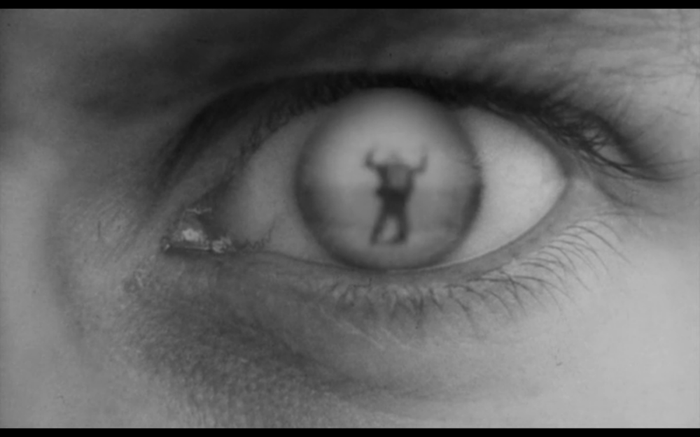
Here are a few screen shots from Overlord, a feature film from 1975, made by Kubrick's some-time Director of Photography, Stuart Cooper. The film fuses some pretty staggering archive aerial footage footage of the D-Day landings with some hypnotic, dreamlike acting scenes of a small group of infantry soldiers going through basic training and then heading off to the Normandy beaches with the allied invasion force.
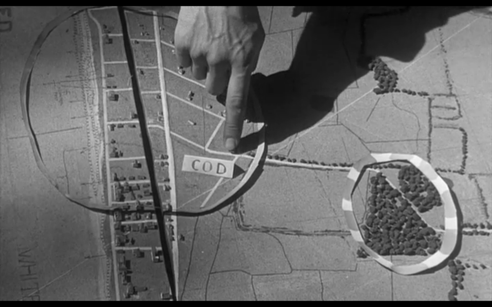
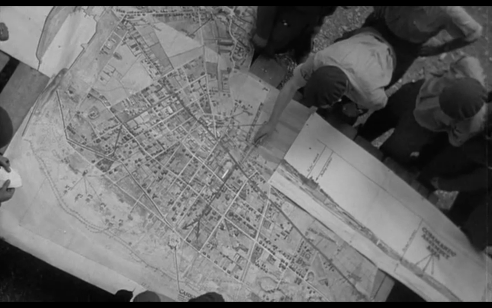
The images here show the kind of home-spun models used by the commanding officers to illustrate the battlefront and points of attack, and illustrate that when trying to convey geographical information, nothing quite beats a flat surface with a map on it and some added local knowledge.
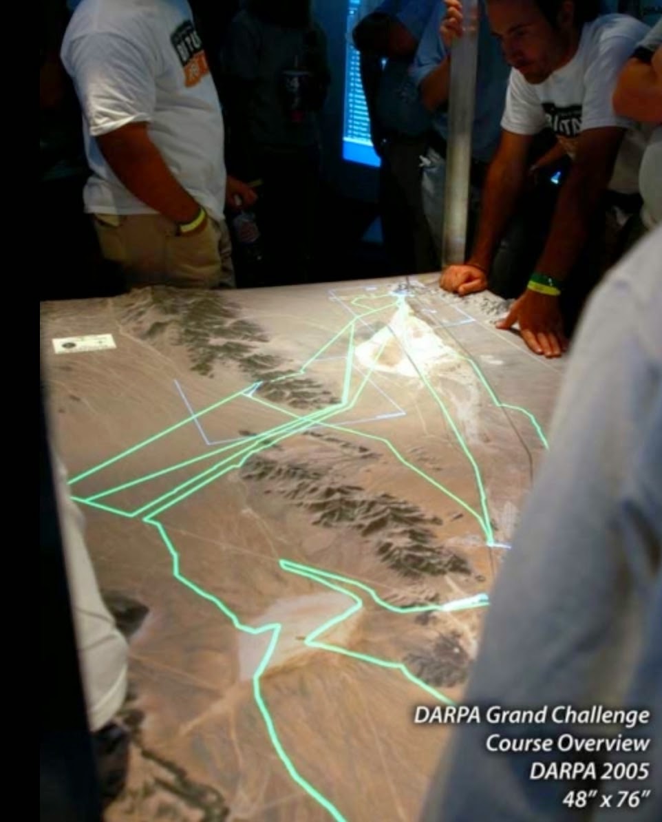
Today, its seems like 3D printing is taking off in a big way in this this sector with the US military commissioning companies like Solid Terrain Modelling to recreating complex topographies, shorelines, borders, points of attack, etc all in miniature.
The extension of maps into three dimensions is not a new concept but it illustrates a kind of leaching of real-world geographies (ie, the third dimension...) into its own pictorial/graphic representation. My current work (in collaboration with Newcastle University) looks at how we might represent invisible airspaces and danger areas in the landscape, but alternatively it might also be possible to possible to represent weather systems, electromagnetic signal distributions, hidden infrastructure and even statistical information as extensions of local geographies.
There is also the question of art. I'm supposed to be making 'artworks' for Newcastle and find it easy to get side-tracked by the purely descriptive. However, I think it is easy to envisage or represent purely imaginative geographies with assemblages of forms that allude to theoretical or abstract concepts - spaces of possibilities.